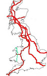
Tuesday 7 April

We strode off into the unknown this morning. Visibility was such that we couldn’t even see the huge car park (which lies adjacent to the road) at the Garsdale viewpoint as we approached. We weren’t put off. We simply chose the bigger of the two hills which we were to tackle from this start point and hoped that the top would be in sunshine.
It turns out that there’s a vehicle track (by which I mean two lines of flattened grass, as opposed to a surfaced track) which leads all the way up this hill. We didn’t know that as we set out, and thus when we hit Ringing Keld Gutter (a beck), we yomped up the tussocky, undulating bottom of the dip in which it runs. I did contemplate, quite early on, climbing up to the top of the dip on the north side, as it looked like the going might be better up there, but it was some time later when Mick did just that; what he found there was the vehicle track. That made the going easier the rest of the way.
If someone, in ancient times, had built a modest burial mound at the location where the trig point now sits on this hill, we would have been saved a couple of kilometres of walking, as that would now be recognised as the summit of this hill. As nobody thought to do that, way back when, we continued another quarter of an hour along the (soggy) plateau until we reached the completely featureless point which is a whole 2m higher than the location of the trig.
With the cloud now rising, we were soon back into it as we made our descent, but happily it had cleared from the valley by the time we got back down. In fact, by the time we reached Colin, we could finally see the nature of what we had just been up.
(7.5 miles; 1900’)
A good long lunch break was had in Colin back at the Garsdale viewpoint (where lots of people were now arriving to take a quick snap of the view before leaving again), before we set out in the opposite direction for Aye Gill Pike.
Well, if we thought the track up this morning’s hill had been soggy, it was nothing to this afternoon’s tyre-track lines through the bog! However, with all of the surrounding land being tussocks as big as I’ve seen, the flattened tyre lines, even if bog-fests, were still preferable to yomping cross-country.
Aye Gill Pike is the lowest hill of this trip so far (556m), but it was the best viewpoint. From its trig we could see every hill we’ve been up on this trip, except for Fountains Fell. And what fine conditions in which to enjoy those views, there being now absolutely no hint of the grey start to the day.
Back through the bogs we went to make our return to Colin after two lovely, gentle-gradient outings.
(5 miles; 1100’)

No comments:
Post a Comment