Wednesday 27 May
Allermuir Hill

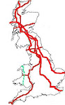
The conclusion I reached on the question of where to head next was that the Pentland Hills lend themselves to longer walks, taking in multiple tops, whereas the Marilyns to the east (starting with the Lammermuir Hills) involve several shorter outings. Given a damp and windy weather forecast for the next few days, I thought the Pentland Hills would be best left for better weather.
We didn't ignore them completely, though, as we nipped up Allermuir Hill on our way past, which (being so close to the city) is an excellent vantage point over Edinburgh. In the other direction is a scene of lumpiness.
Having visited our top (where we shared the summit with five other people, even though the day was still relatively young), the sensible route back down seemed to be along the ridge and over Caerketton Hill, so that's exactly where we went. I can't say that the second top gave views that were wildly different from the first, but the walk was a very nice one (3.5 miles, 1200').
Meikle Says Law

Back down at our starting point, Colin's nose was then set towards the Lammermuir Hills, where we arrived just at lunchtime.
After a nice leisurely lunch (which, it turned out should have been at least 10 minutes shorter), my inclination to sit under a blanket with a book was far greater than my inclination to go and walk up a heathery lump which was smothered in tracks. I did, however, drag myself (and Mick) out, and soon discovered that my initial, unfavourable opinion of the hill was unjust, as we were soon off the surfaced tracks and onto tyre lines through heather, which eventually petered out completely to give us a rough heathery yomp to the top. (The OS has that track down as double dotted lines; I don't think it warrants that status; neither did our descent route, for that matter.)
So much did my opinion of the hill increase whilst we were on it that I decided against the option of retracing our steps and went back to the original plan of forming a circuit over Little Meikle Law. That was rough and heathery too, but easier going than the last bit of the ascent.
Having left Colin at around 1350', and with a summit height of around 1750', at a very quick glance this may have looked like a very low ascent sort of an outing. However, the first thing we did when setting out was to descend quickly down to a burn. That, of course, meant that the final thing we had to do was regain that height: a sting in the tail. To make that final climb worse, the rain which had already been falling lightly for a while really upped the tempo for the final ten minutes of our outing. With our end in sight, it didn't seem worth stopping to don overtrousers, so all we could do as our legs got soggier was to rue not finishing our lunch ten minutes earlier. (5.6 miles, 900')

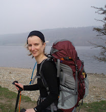
(If today's snap was of better quality, you'd be able to make out Colin and a windfarm in amongst the landscape (incidentally, six windfarms could be seen from Meikle Says Law))

No comments:
Post a Comment